
Professional Geographic Information System (GIS) & Mapping Services
Why Choose CFB GIS & Mapping?
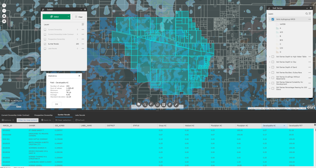
Seamless Data Integration: CFB’s GIS & Mapping division merges spatial data with various data streams to provide modern mapping services for our client’s projects.
Customized Solutions: The team is proficient in several software packages allowing us to offer tailored solutions, including real-time scheduling visualization and customized dashboards.
Curated Land Utilization Data: The GIS division at CFB has curated a comprehensive proprietary repository of regional land utilization data and metrics. This resource uniquely empowers a focus on tailored information for plan amendments, rezonings, and annexations. A dedicated team of in-house programmers and analysts maintains these datasets to meet specific client needs.
CFB's GIS team provides custom mapping services and specialty drawings to fit clients’ specific needs including:
- Schedule development and tracking
- Custom project mapping and presentations
- Community Development District (CDD) creation and support
- Deployment of a standardized address system that integrates multiple county businesses including E911, coordinates with the United States Postal Service and development of zip codes
- Implementation of organization-wide design and specification criteria
- Creation of marketing materials including specialized maps and sales packages
- Providing statistics to understand historical data and make informed decisions on future projects
- Maintain working relationships with local and state agencies
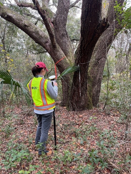
- GIS based site assessments and statistical demographic analyses
CFB GIS & Mapping uses the following Technologies:
- ArcGIS Desktop
- ArcGIS Online
- ArcGIS Enterprise
- ArcGIS 3D Analyst
- ArcGIS Geostatistical Analyst
- ArcGIS Network Analyst
- ArcGIS Spatial Analyst
- ArcGIS Publisher
- QGIS
- AutoCAD Civil 3D
- Tableau
- Smartsheet
- Python
Data CFB’s GIS team has maintained include:
- Land Development Constraints
- Land Entitlements
- Record Plats
- Construction As-builts
- Utility Design
- Project Schedules
- Cost Repositories
- Projected Sustainability
- 911 Databases
- Requisition Tracking
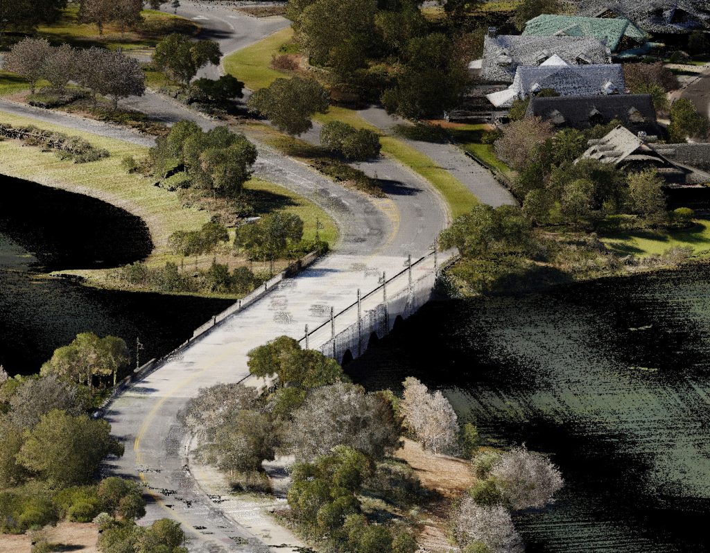
- Historical Aerial Imagery
- UAV Imagery
- Construction Phasing
- Maintenance Responsibilities
- Residential Development
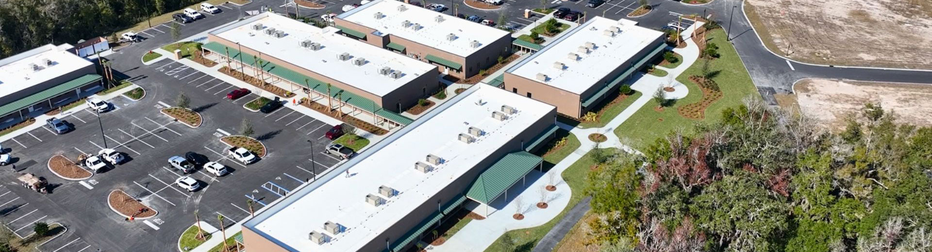
- Commercial Development
- Industrial Development
- Soil Borings
Projects CFB’s GIS team has delivered include:
- Drainage Studies
- Travel Time Studies
- Projected Land Utilization Studies
- Web Based Due Diligence Reporting
- Soil Analyses
- Interactive Utility Dashboards
- FEMA Revisions
- Cut\Fill Analyses
- Development Research Applications
- Historical Survey Research Applications
- Master Planning Interactive Map Applications
- Map Series for Budgeting and Planning
Proud to be part of the Esri Partner Network.
Founded in 1969, Esri has become the global market leader in geographic information system (GIS) software, location intelligence, and mapping.
As a partner we collaborate with Esri to help users maximize their GIS and location technology investments.
Related Projects
Experience the difference that decades of expertise, a broad skill set, and a client-focused approach can make in your next project.
Our GIS & Mapping Team
GIS & Mapping Team consists of:
- GIS Analysts
- GIS Technicians
- CAD Technicians
- Project Coordinator
- Programmers


Locations


CFB Ocala Has a New Home! Learn more about CFB Ocala.